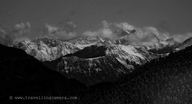
Pir Panjal Range is a mountain range in the Middle Himalayas running from east south east to west north west across the states of Himachal Pradesh and Indian administered Kashmir in the Republic of India as well as Pakistan administered Kashmir...
All these photographs have been clicked during one of m Dalhousie trip... Dalhousie Mall Road has amazing views to PIR PANJAL mountain range... Here are few photographs of PIR PANJAL which are clicked from Mall Road @ Dalhousie, Chamba, Himachal Pradesh, INDIA
Dalhousie Mall road starts from Subhash chowk and this photograph has been clicked after few minutes of walk from Subhash Chowk.. towards main market of Dalhousie, also known as Gandhi Chowk...
The eastern segment of the range forms the watershed that separates the Chenab (Chandrabhaga) river basin from the Beas and Ravi river basins...
Zoomed view of PIR PANJAL from middle of the Mall Road @ Dalhousie, Chamba, Himachal Pradesh... I have used Nikon D90 with 18-200mm to click all these photograph.. and most of them are clicked in the evening....
Rohtang La is a mountain pass on the eastern Pir Panjal range. It connects Manali in the Kullu Valley to Keylong in the Lahaul Valley. ..
This is clicked from Gandhi Chowk and the green hill on the right is the one where Dalhousie Public School is situated... Its very popular boarding school in Himachal Pradesh...
Haji Pir Pass is a mountain pass on the western Pir Panjal range between Poonch and Uri (India).
Haji Pir Pass is an important outpost manned by the Pakistan Army. The pass witnessed Pakistani aggression during both the 1965 and 1971 wars. India captured this pass in the 1965 war due to lack of Pakistani strength in that area and was later returned to Pakistan during exchange of each others territories. During the 1971 war, Pakistan army repulsed to Indian attacks on the post. This pass today continues to be part of Pakistan Occupied Kashmir...
Clouds moving up from PIR PANJAL mountains... and let me share that Dalhousie gets heavy rainfall in himachal pradesh ... snowfall also...
Deo Tibba (6001 m) and Indrasan (6221 m) are two important peaks at the eastern end of the mountain range. They can be approached from both the Parbati-Beas Valley (Kulu District) and the Chandra (Upper Chenab) Valley (Lahaul and Spiti District) in the Indian state of Himachal Pradesh.
The hill stations of Gulmarg in the Indian state of Jammu and Kashmir lies in this range.
(Courtesy : Wikipedia)


.jpg)
Comments